Puerta del Sol Square
The natural starting point: clock tower, city life, Metro access, and the constant movement of the centre.
Open map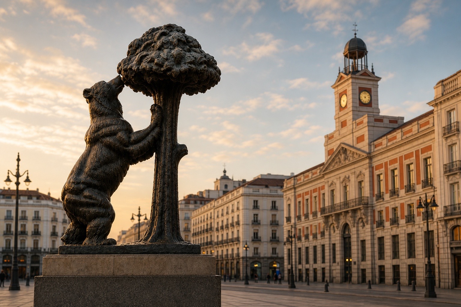
Near the monument
A practical map for turning the bear photo into a real walk through central Madrid.
Nearby
Filter by approximate walking time from the statue. Distances are indicative, so check the route on the map before leaving.
The natural starting point: clock tower, city life, Metro access, and the constant movement of the centre.
Open mapThe plaque from which Spain’s radial roads are measured, beside the Real Casa de Correos.
Open mapThe clock building used for the New Year bells, and a key part of Puerta del Sol.
Open mapMadrid’s grand arcaded historic square, an easy direct walk from Sol.
Open mapA covered food market, useful for a snack without leaving the Sol-Plaza Mayor axis.
Open mapCommercial architecture, cinemas, and a quick shift into Madrid’s more vertical streetscape.
Open mapOne of Madrid’s most recognisable urban views, on the way towards Alcalá and Cibeles.
Open mapLiterary streets, smaller squares, and a calmer route away from Sol’s busiest edges.
Open mapA natural extension from Plaza Mayor towards Ópera and Madrid de los Austrias.
Open mapA street of taverns and classic atmosphere that turns a walk from Sol into an evening plan.
Open mapWalking times are approximate from El Oso y el Madroño.